A new home for my blog site open.gis.lab

New website of open.gis.lab
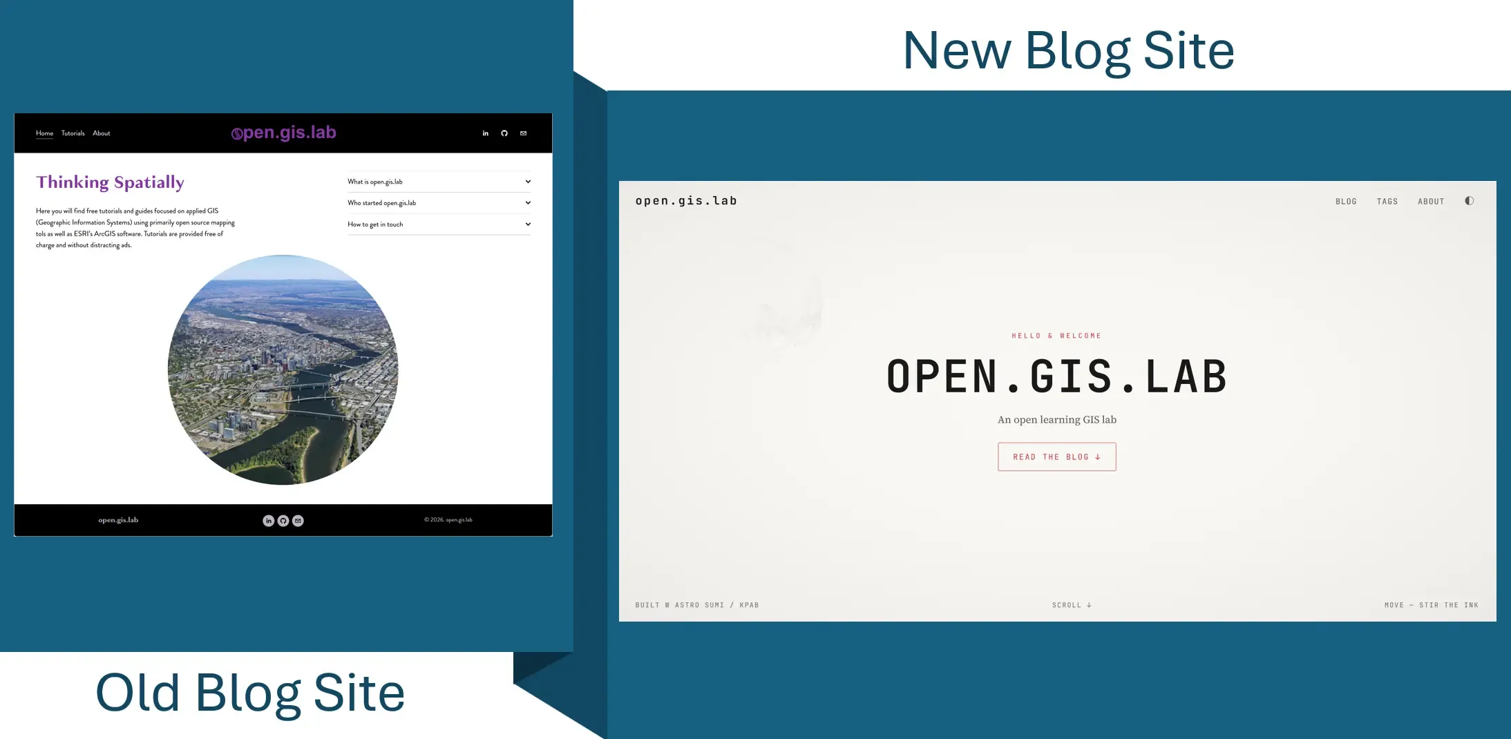
image of old open.gis.lab site

Hello, it’s me

Hi! After a long hiatus, I am back to writing on my blog. Longtime readers will noticed that my site now looks different. I have switched from Squarespace to Astro. When I first started writing my blog in 2016 I used Squarespace because it had nice templates and it was easier to use then WordPress. It was ok, but the costs of maintaining my site on Squarespace and plus the fact that I’m finding it inefficient to write on the platform. I’m hoping I can write/publish more now that I’m using markdown to write.

Blog post archives

I have archived most of my old blog posts from my old Squarespace site to here. Only my blog posts from 2024 that I feel are still relevant will be ported out to this new site. Older posts from April 2022 are archived as pdfs that can be viewed or downloaded in the table below. Most of them I feel are less relevant now as they were when I first wrote them - technology has changed and AI can automate many tasks.

Blog Post Date Published
Connecting to Google Cloud Storage in ArcGIS Pro 2022 Apr 22
Customizing Esri Vector Basemaps using the Vector Tile Style Editor 2021 Oct 06
Exploring a Digital Atlas of Maps and Imagery on Soar.Earth 2021 Jul 22
Accessing Cloud Optimized GeoTIFFs in ArcGIS Pro 2021 Apr 26
Storytelling with Cesium Stories Application 2021 Feb 06
Introduction to QGIS - GIS Day 2020 Virtual Workshop 2020 Nov 20
Wind Vector Mapping and Animation in QGIS 2020 Oct 20
Exploring MapStore as an Opensource Web Mapping Framework 2020 Oct 04
Mapping and Viewing Geotagged Photos in QGIS 2020 Aug 23
Setup QGIS Print Layout to use Inch Instead of Millimeter 2020 Jul 02
Viewing ESRI Basemaps in Google Earth Web and Pro 2020 Feb 27
Got GeoJSON Error? - Tip on Adding GeoJSON via URL in QGIS 2020 Feb 02
Label Rotation in QGIS and ArcGIS 20200101.pdf 2020 Jan 01
Converting ESRI Styles to QGIS XML Using SLYR 2019 Mar 21
Tips for Creating ArcGIS-like Symbology in QGIS 2019 Feb 10
Adding and Viewing GeoJSON in QGIS and ArcGIS 2018 Nov 10
Using QGIS, Lizmap Plugin and Web Client to Publish Web Maps 2018 Jul 19
Updated - Installing Apache, QGIS Server, and Lizmap Web Client on Windows OS 2018 Jul 11
Flood Mapping with Sentinel-1 Data using SNAP and QGIS 2018 May 28
Adding Basemaps in QGIS 3.0 2018 Apr 20
3D DEM Visualization in QGIS 3.0 2018 Mar 21
A Simple Leaflet Web Map Example 2018 Feb 24
Blogging Offline Using Markdown and Brackets 2018 Feb 02
Using USGS TNM Vector Data to Create Seamless Topographic Maps in ArcGIS 2011 Dec 19
Installing Apache, QGIS Server, and Lizmap Web Client on Windows OS 2017 Dec 15
GIS4DAR ArcGIS Training Workshop - September 7-8, 2017 2017 Nov 08
Open Source GIS Implementation - Part 4 Installing GeoServer 2017 Apr 12
Open Source GIS Implementation - Part 3 Creating PostGIS Database 2017 Mar 27
Open Source GIS Implementation - Part 2 PostgreSQL_PostGIS Installation 2017 Mar 26
Open Source GIS Implementation - an Experiment 2017 Mar 25
Open Source GIS User Group - Intro to QGIS 2016 Jul 25
Open Source GIS User Group Meetup - Notes & Summary 2016 Jun 14
USGS TNM Style Map Template - ArcGIS 2016 May 21
How to convert geopdf to geotiff using GDAL 2016 May 15
How to convert geopdf to geotiff using ArcGIS 2016 May 09