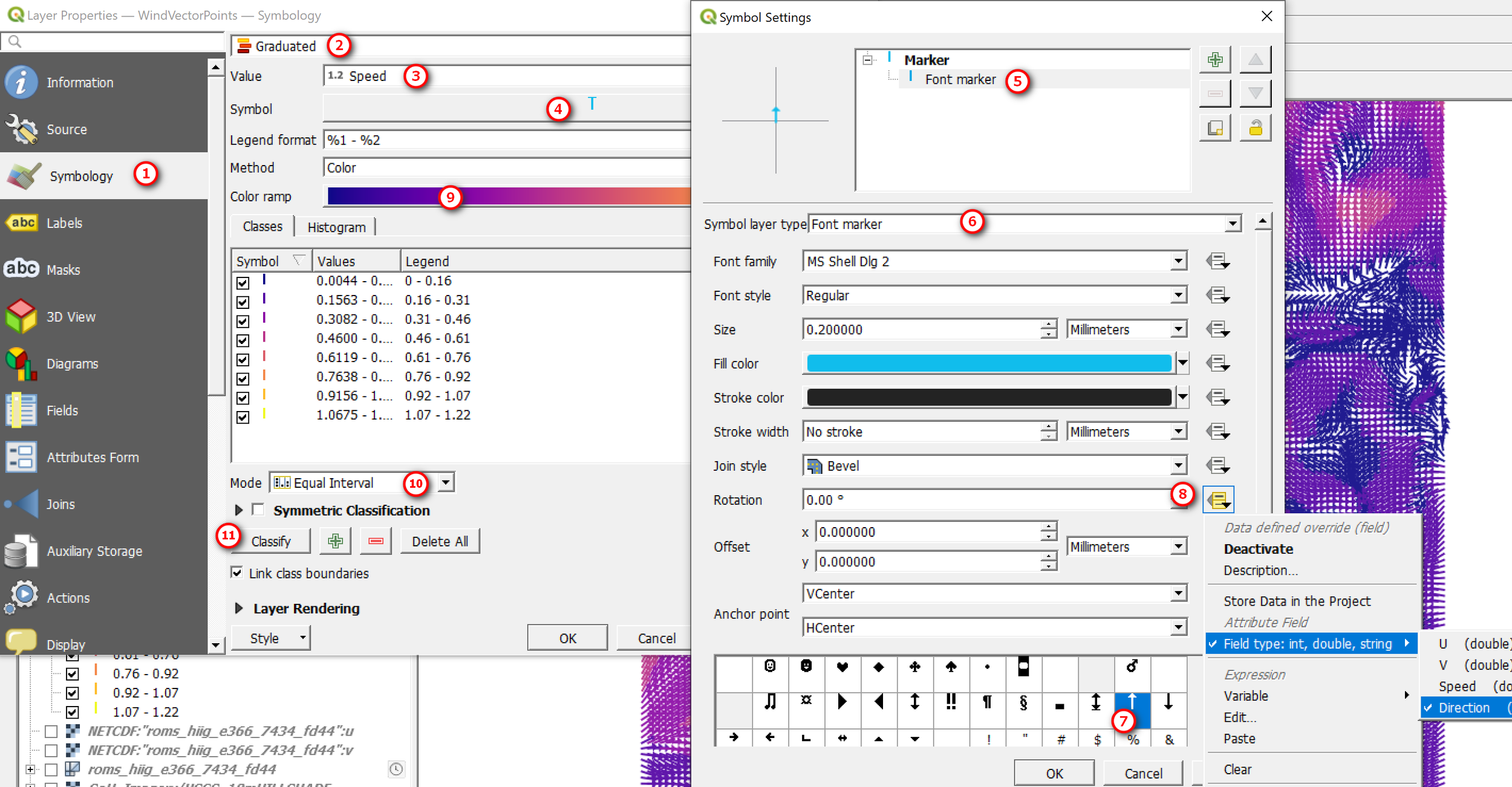
Converting raster wind vector to a point layer with u, v, speed and direction
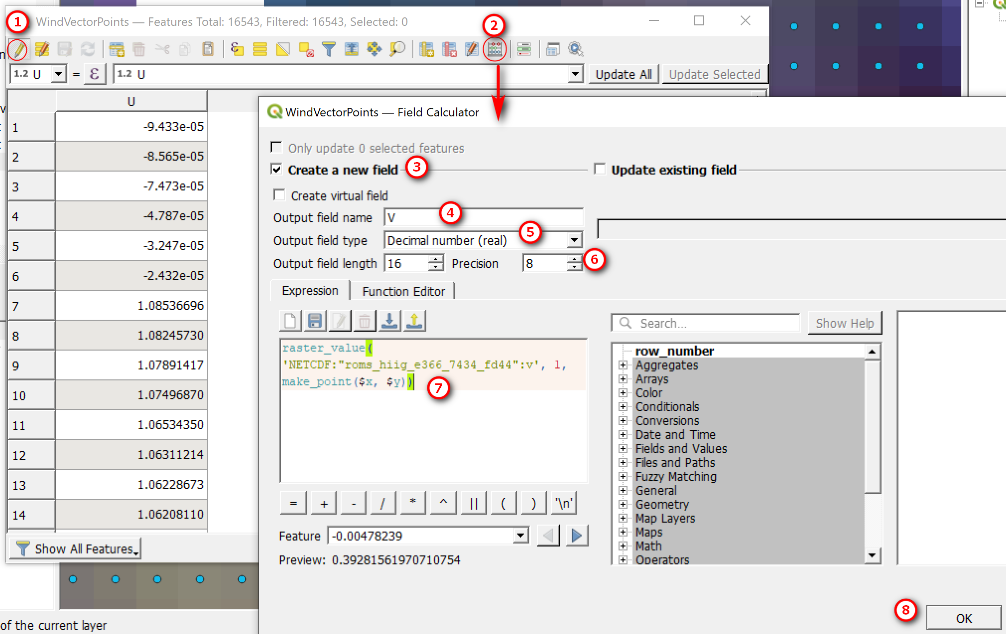
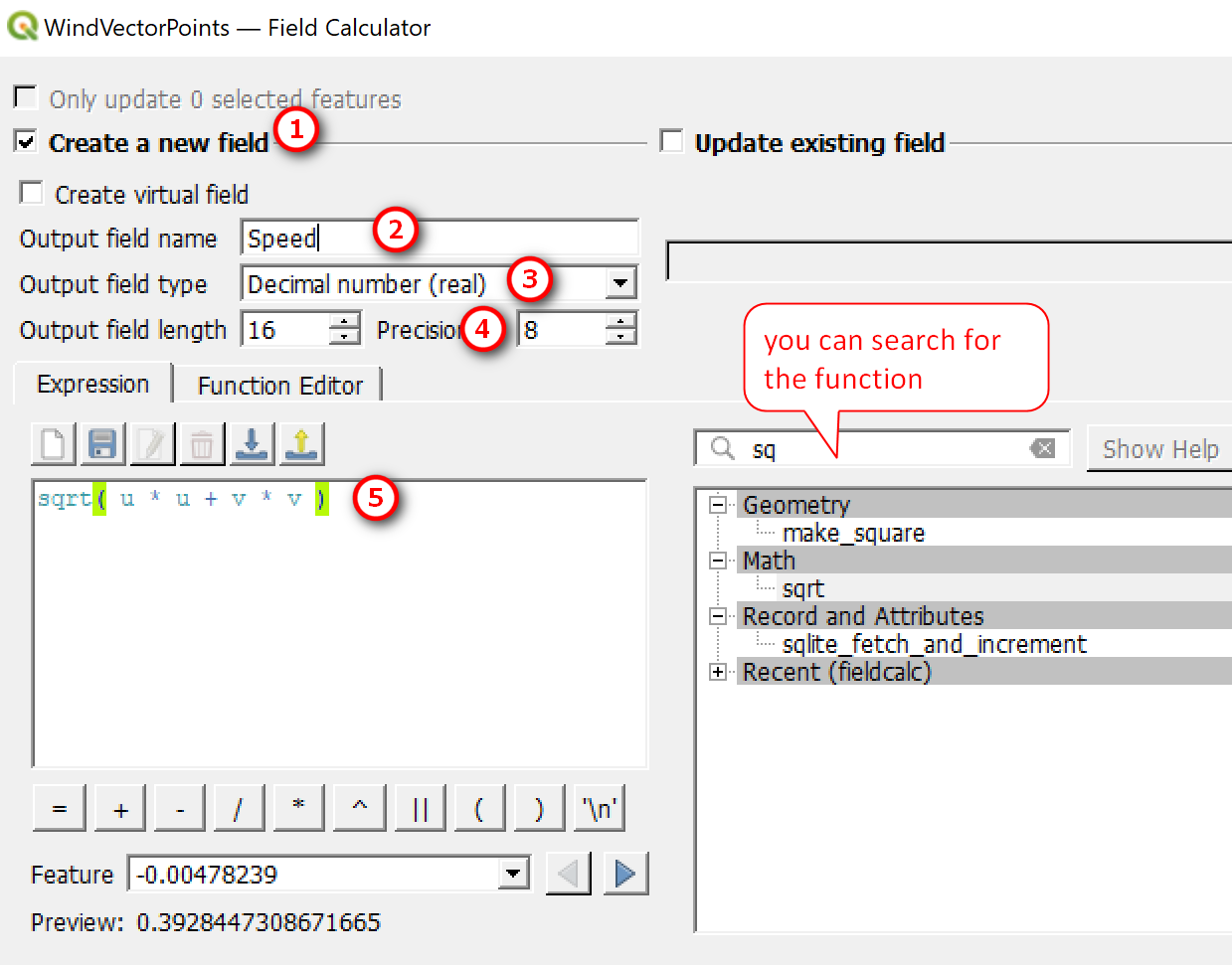
So, what if you have raster(s) containing the u (eastward x-axis) and v (northward y-axis) components and you want to convert to a point layer (e.g. shapefile) and use arrows to show the wind speed and direction (wind vectors). This section will show you how to do that. But first, you’ll need to do some calculations. See this wind direction quick reference for calculating wind direction and speed and other tips. Also keep in mind that wind direction is described differently for oceanography and meteorology. Oceanographers describe the wind in the direction that it’s flowing towards and meteorologist describes wind in the direction that it’s flowing from.
Wind Speed (magnitude) = sqrt ( u * u + v * v )
Wind Direction = Atan2 (v, u) is the same as Atan2(y, x)
If you read the quick referenced guide linked above, there is tip on some software, especially spreadsheets using the Atan2 (x, y), where x and y are switched. QGIS uses the atan2(y, x), which return values in radians. To convert radians to degrees (symbol rotation), multiply it by 180/pi.
Oceanographic Convention: (180/3.14) * Atn2(v, u)
Meteorological Convention: (180/3.14) * Atn2(v, u)+180
Instead of using the mesh version of the netCDF data, add the raster version of it into your map. When you double click on the netCDF raster, QGIS will ask you to select variables you want to view. Select the u and v components and add to your map

